I decided that some of the maps I've "made" by plotting trails w/my GPS might be of interest to others. So here are a few.
Castle Trail (Closed as of May 2013)
Halapepenui from Hapaki Street
Iliahi Ridge Dec.11
Kaipapa`u Waterfall Hike 3.22 miles one way
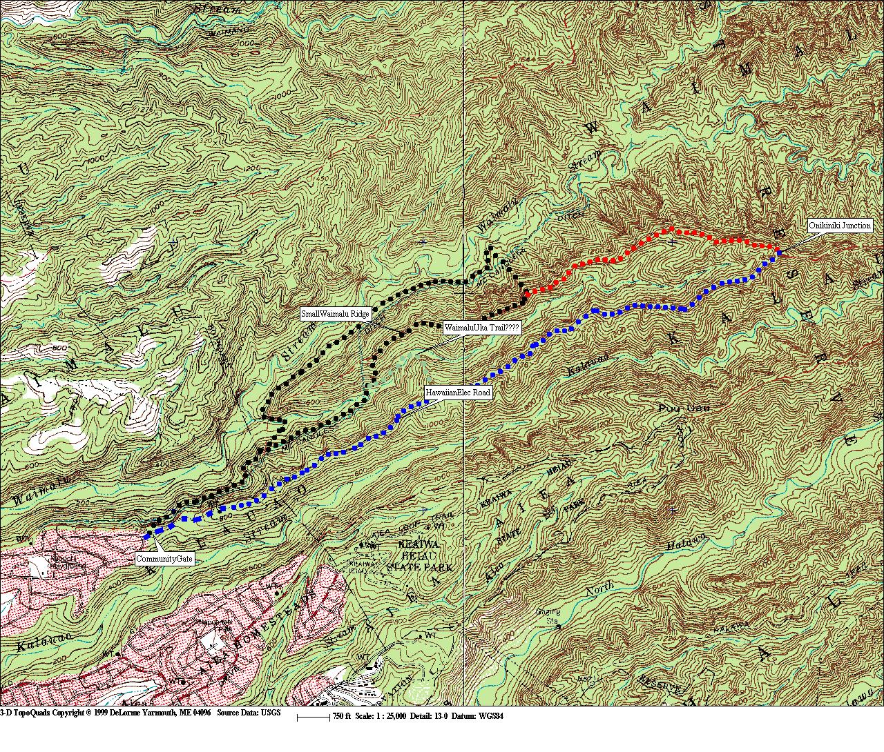
Kalauao Loop (Start on Aiea Loop Trail)
Keaau Ridge (Call 587-0166 ask for Na Ala Hele office you might get the combo to open the lower gate.)
KST-1-North-created 4/7/12
KST-2-Middle-created 4/7/12
KST-3-South-created 4/7/12
Kumaipo Trail (Ancient Hawaiian trail connecting upper Wai`anae and Makaha valleys. NOTE Makaha is CLOSED WATERSHED, w/NO public access)
Kuolani-Waianu (No Access w/o permission from Board of Water Supply)
Laie to Castle (Note permission is need for both the Laie and Castle trails)
Palm Valley Dec.11
Manoa Middle Ridge (Notes are for hiking CCW)
Olomana Express (hiked from Waimanalo)
Olomana-Hope (Hiked CCW)
Pu`u Kaua Trail (Temp. CLOSED by State of Hawai`i)
Wai`anae Ramble w/Bail Out Trails
Waimano (Lower Area) Hike Aug 2012-Gray is actual hike.
Water Walls and Water (Wai`anae Valley)