There are a number of old military sites at and on the ridge above Kaena Point. Today Dave, Stanka, Gene and I went out to look around. Some research on the web, Googling, resulted in the below information from a PDF file entitled "Historic Properties Summary, Ka`ena Point". At this point I don't know who put it all together. Quotes from the file are in italics.
By far the most ambitious and complex project
undertaken at Ka`ena Point was construction of a battery designated “Battery
Construction No. 409” (BCN-409). Begun in mid-1943, the facility was
designed to support two 8-inch naval guns and army M1 barbette carriages. In
general, these guns were intended to strengthen coverage of coastal defense
positions along the north and west shores of O`ahu. In particular, they were to
defend against coastal landings and to provide additional protection for the
Lualualei Ammunition Depot and Mokule`ia Airfield. BCN-409 was only 60% complete
when the project was abandoned in 1945. A May 31, 1945 study of seacoast battery
requirements determined that batteries of this type could not withstand attack
by “modern” air or naval bombardment. Given technological advances made during
World War II, the design of these batteries did not provide sufficient overhead
protection for the guns and they were therefore unable to meet the needs of a
seacoast
defense system of the time.
The design of BCN-409 called for construction of
two gun emplacements; a tunnel complex excavated into the ridge at an elevation
of 125 feet. The tunnel complex, designed to house all support operations,
powder magazines, and electrical generators and compressors, was composed of two
access tunnels connected internally by two traverse tunnels. All chambers were
15 feet high and 15 feet wide. The northern access tunnel
was the longest at 200 feet; the southern access tunnel extended underground for
40-50 feet; and the two traverse tunnels were 75-85 and 100 feet long. The
tunnel entrances were spaced 300 feet apart and were accessed by an 18
foot-wide, 2,483 foot long gravel road that approached the tunnels from the
northwest.
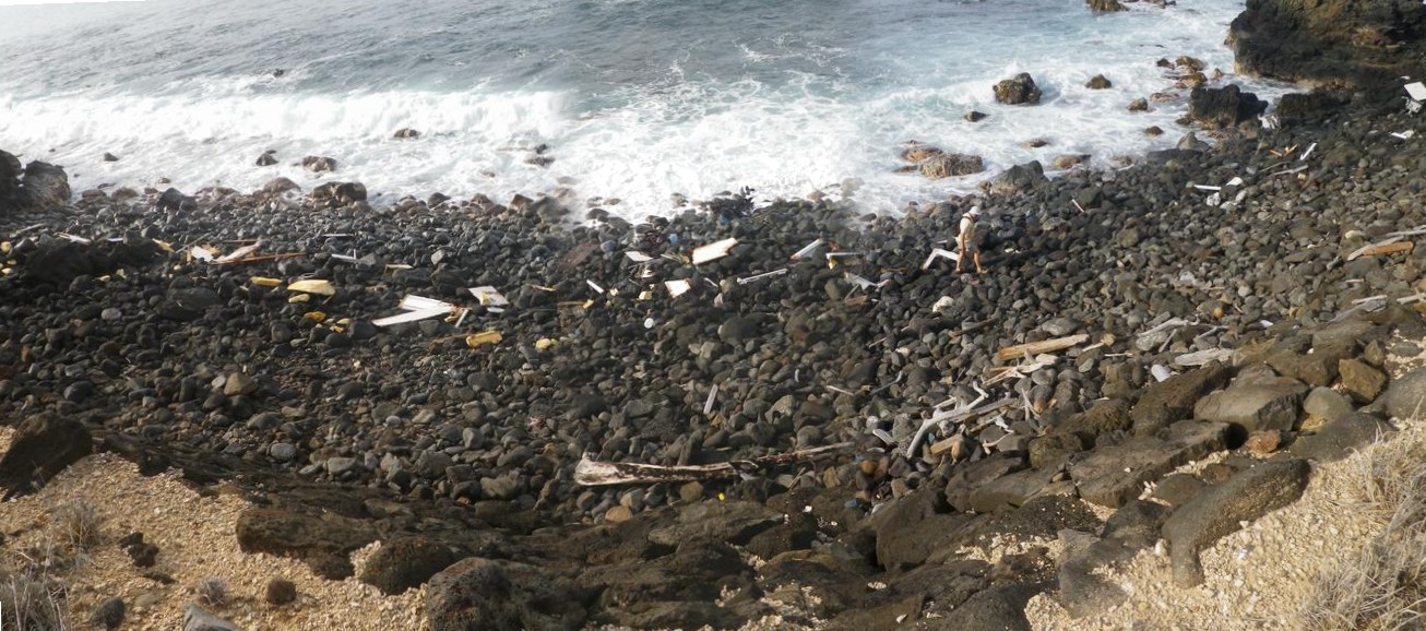
On the way out to the point Dave noticed some wreckage on the rocks below the old railroad bed. He went down to look and I took this panorama photo of the debris that had washed up on shore. To the left of Dave right on the water line is a black object. If you click on it you'll get a close up of the engine.
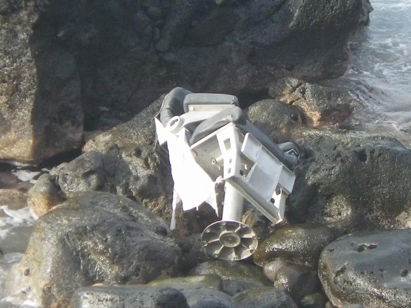
One of the seats from the boat was also laying up on the rocks. We later met a guy who would try to clean up some of the wreckage. He told us it belonged to a solder from Schofield. He was out fishing Thursday night when he lost engine power and drifted on to the rocky shore line. The main part of the hull must have sunk. The owner managed to get out alive w/little injury to himself.