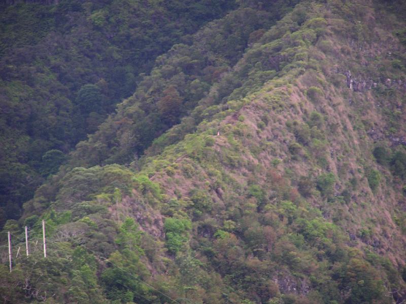
For most of the first 1000 feet of elevation gain (stream 1550') the ridge is pretty broad. Around 2500' it suddenly gets narrow to say 6' with the trail running down the middle and steep drops on both sides. At the first open spot on this narrow section I took this picture. It is looking sort of east toward Mt. Ka`ala. You can see the "Three Pole" (2800') marking the top of the access ridge on the Mt. Ka`ala hike. Then to the right is the long slow climb gaining altitude all the way to the highest point on O`ahu at 4025'. Right in the middle of the picture on the narrow ridge is a white dot. What that is, is the white stripes on the American Flag I put up to remember my good friend Bal who passed away in late march just a few hundred feet higher on the trail. Looking at the picture, it's a good thing his heart attack came where it did, because if he had fallen off the ridge we might never have found him. I had to put the flag lower than where he passed away as the ridge there is to narrow and the flag pole and fluttering flag would have made it dangerous for hikers. As it is the flag is located where the chopper set down one "foot" to pick Bal up.
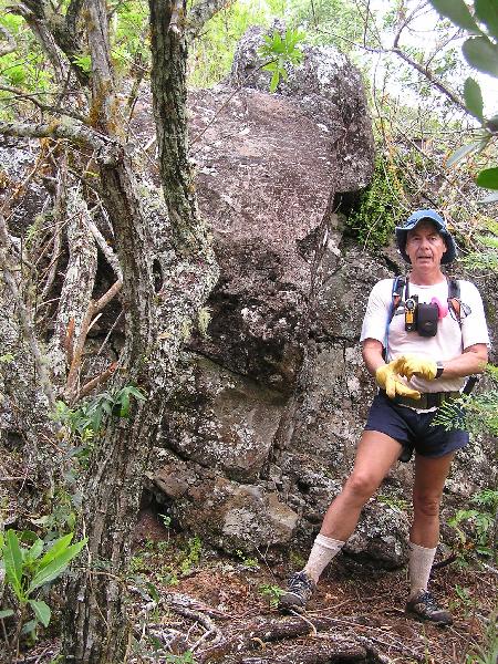
As the ridge got narrower we came to a rather large rock, bolder right on the ridge. This first one has a trail we opened on the right and then a scramble up the side of the rock. Sorry no pictures. The second rock face is a bit higher and there is no way around it. You must climb it. Here is a picture of Danny and the rock face. It took us almost 2 hours to get to this spot from the stream bed below. Now that the trail is cleared it should be a lot faster.