After about 1 hour and 20 minutes we reach the turn off spot marked by the yellow ribbon in the picture. Its easy to miss. The tree also has some bark scraped off as a marker. The road continues deeper into the valley to other trails reaching the Tripler Ridge on the right.
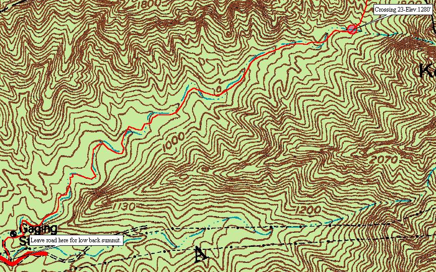
The map below shows the 2nd part of the hike. Along this section you must cross the stream 23 time. This is still the novice part of the hike. Crossing the stream 23 times sounds difficult, but its not. Then stream is narrow and in most places you can safely hop across rocks. The red line indicating the trail is not accurate in its placement. The trail is obvious and you cant get lost. There are even ribbons to follow if you cant "read" the trail.